After a sleepless freezing cold night camping at Smoko Campground near Bright, I set out for Mount Buffalo National Park to tackle a couple of walks, the first of which was Eurobin Falls (yes, another waterfall to photograph is a good incentive to put on the hiking boots). After clear skies during the night, which enabled me to have a go at photographing the milky way at 5 o’clock in the morning, the day started overcast and deteriorated from there.
As my drive up Mount Buffalo Road took me higher, the clouds started to close in. However, the lack of sun is actually a good thing when photographing waterfalls – I will be writing a post about this in the next few days.
I made the mistake of looking for the falls walk when I reached the Eurobin Creek picnic area, not realising that the Falls walk is another couple kilometres up the road. The car park on the left hand side of the road going up the Mount is nothing more than roadside angle parking.
The track takes in two waterfalls, the first being Ladies Bath Falls than can be viewed from the footbridge across the creek, or in my case from the rocks at the side of the track. The track to this point is a pretty easy incline over a distance of no more than 400m from the road.

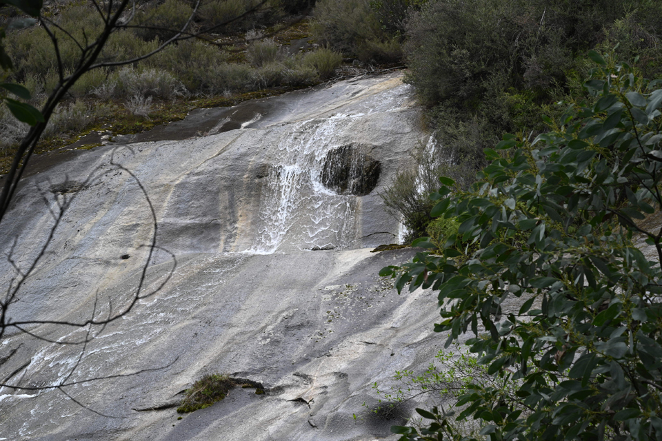
From here the track continues on to a viewing platform at the base of the Lower Eurobin Falls. These Falls are very similar in nature to Wilhelmina Falls in the Murrindindi Scenic Reserve (see my previous post) in that the water flows over a granite sloping cliff face, fed from the Upper Falls that are more like waterfalls as we know them. There are regular signs warning visitors to stick to the paths due to the very slippery rocks that have led in some cases to fatalities. Warnings like this are to be heeded!
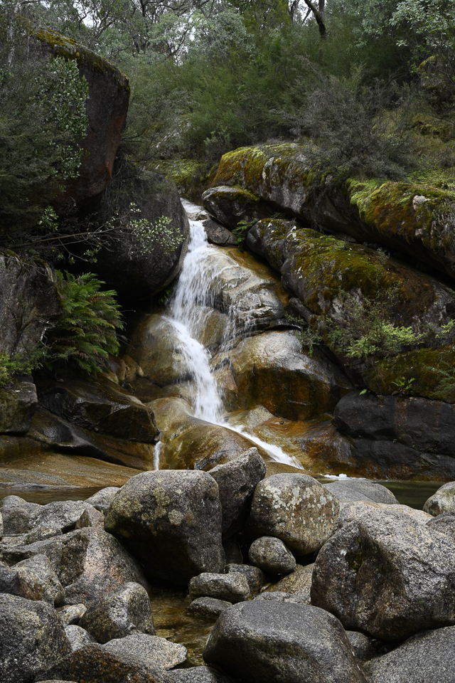
From this viewing platform the going gets a lot tougher with numerous steps up to a viewing platform at the base of the Upper Falls where the strength of water can readily be seen in the way it is has carved its route through the hard rocky face. I must say that the Upper Falls are more impressive than the Lower section, however, for me, the Ladies Bath Falls beats them both.
As I have received a few requests to show my walks on a map, I am in the process of trialling an app that does just that, as well as providing a range of statistics. This walk took me almost 40 minutes, apart from stops to photograph, the recorded distance was 1.95 km, and the increase in elevation was 99m. (I am still trying figure out how to download the map.)
On completing this walk, my next challenge was Rollasons Falls, further up the Mount, a challenging it certainly was. Keep a look out for my next post.
As usual, there are more photographs on this web site gallery and I welcome any comments you may have about your own experiences below. Thank you for reading.