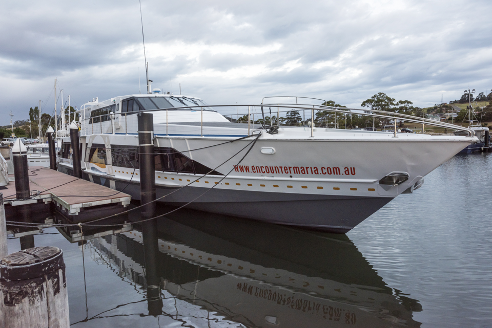
On our way from the Tasman Peninsula to the Bicheno, we stopped overnight in Triabunna so that we could catch the early ferry to Maria Island for a quick visit. Given we had about 5 hours on the island, we were not sure how many of the short walks we could complete, but as it happed, we managed three.
Maria Island lies to the east of the mainland with the nearest land mass to the east being New Zealand. Between 1825 and 1832, the island served as a penal station with the convicts being accommodated in a series of huts that forms the Darlington settlement. Due to numerous escapes and disorder, the station was closed down, only to be re-opened ten years later as a probation station. This lasted a few years, when in 1850, it closed for good. However, a number of industries, including running sheep, and a short lived cement works followed. The island was eventually declared a National Park in 1971 and is now a wildlife sanctuary that offers many short, one day and overnight walks. Overnight visitors can take their own tent or be accommodated in the bunk rooms that previously accommodated the convicts. There is no shop on the island so visitors must take their own provisions and, of course, take their rubbish off the island when they leave.
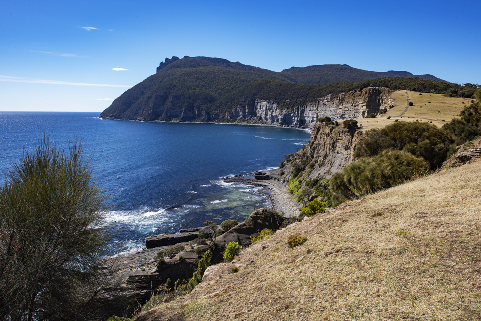
On disembarking we headed on the track to the north of the island on the Fossil Cliffs walk. This was a fairly easy walk along a rough vehicle track round the headland to the cliffs. Along the way we had views to the north and east where the profile of Freychinet was prominent, beyond the nearby small Ile Du Nord. At the Fossil Cliffs, about 45 minutes into the walk, we were able to examine a range of fossils and views of the Bishop and Clerk headland to the south. Faced with a rather long steep climb to the headland, we branched off the south west in the general direction of Darlington.
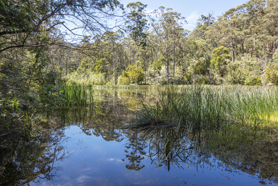
A third of the way to Darlington at the Engine House and Kilns, we took a left hand turn to head to the Reservoir. This north east leg of the circuit follows the course of the Bernacchis Creek that flows into and out of the reservoir. Approximately two thirds of the way we turned up a track to the left that leads up to the old quarry, that presumably supplied stone for the settlement. After retracing our steps from this small detour, we progressed on to the reservoir. On arriving we found one of the most tranquil scenes on the island – a peaceful, calm and reflecting body of water. Along with three other families, we lingered there for morning refreshments before setting of on the return leg of then circuit on the other side of the creek. The circuit is a very easy 4 km walk that can be completed in one and half hours from Darlington.
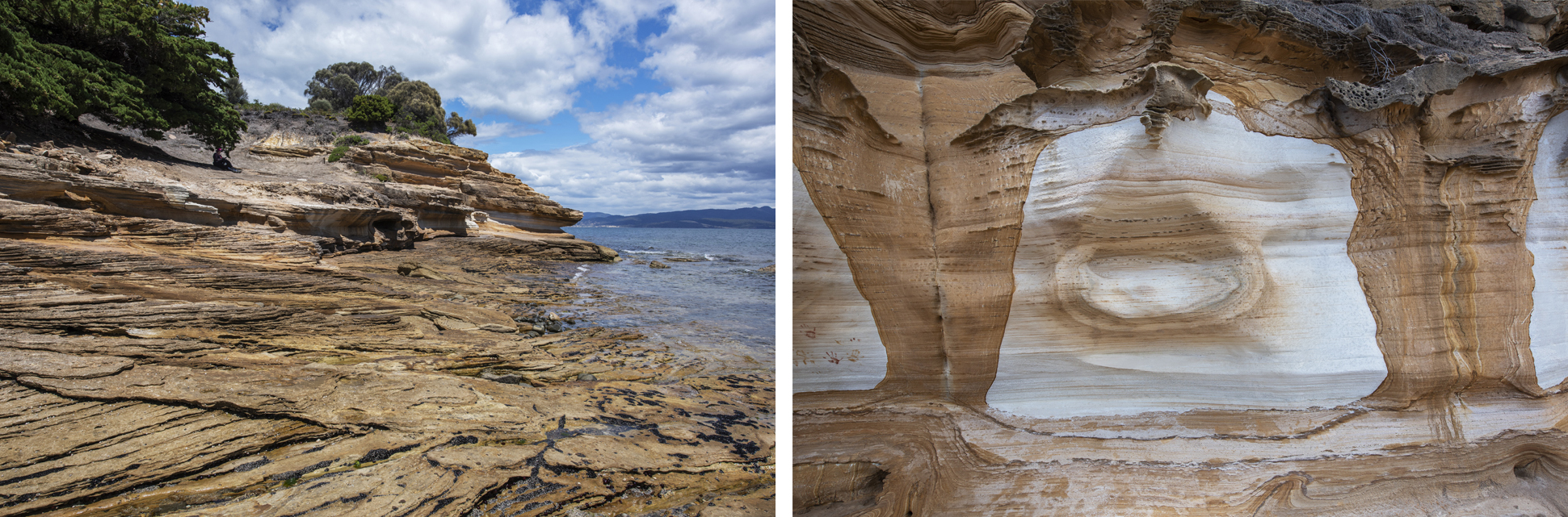
On arriving back at Darlington, we decided that we had enough time for a quick lunch and to take in one more walk – to the Painted Cliffs This started off as a long slow climb up a vehicle track past Ruby Hunts Cottage and down the other side to Hopground Beach. From here we could see what we assumed to be the Painted Cliffs at the opposite point. The did not look too inspiring from here, but we progressed on, taking the hard sand route round the beach. The close up view of the Cliffs at this point was still rather disappointing, but, having seen others manage it successfully, I braved the high tide to negotiate an overhang. Thankfully! The sight round the corner was quite spectacular. The colours and patterns in the eroded cliff were quite unique and offered a great photographic subject, with which, of course, I spent some time, to the extent that I think Kerena was wondering if I was going to re-appear!
We decided to take the Oast House track on the return leg. As the name suggested, this took us past the derelict Oast House where we discovered that the climate and soil is great for growing hops. So, I guess it was no surprise that one of the first buildings to be constructed was the brewery.
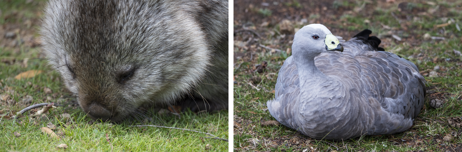
Taking the full estimated 2.5 hours for the walk, we arrived back at Darlington at about 2 o’clock in time for the 2.30 ferry. On all three of these walks, we were on the lookout for the wildlife that, due to the lack of predators, roams free and easy, but it was only until we arrived for the return ferry that we were rewarded. We almost fell over wombat behind the Ranger’s office and one other sighting close to the campground facilities. Around the Darlington settlement we also saw quite a few Cape Barren Geese. So, leaving disappointed without seeing any wildlife was avoided.
In total we covered about 16 km across some easy tracks. This combined with a further 4 km on our Bicheno evening walk after arriving there resulted in a total of 20 km – a distance we were to repeat the next day when we tackled the Wineglass Bay Walk – look out for my next post.