We arrived on Bruny Island on the 09:30 ferry with the intention of a quick drive around the north end of the island before completing our journey to the campsite at the southern end. Since we had the whole day, we decided to tackle at least one walk on the way. Our selected walk was the Fluted Cape walk.
Turning east off the main road just past The Neck towards Adventure Bay, we parked up at the end of the road, had a quick lunch and set off. There are three options for this walk: a return walk to Grass Point; a clockwise circuit to the Fluted Cape or an anti-clockwise circuit to the Fluted Cape, with Grass Point featuring in these last two options.
We decided on the clockwise direction, taking in Grass Point on the way. By walking this way, we were faced with a steep climb on leaving Grass Point up to the Cape but a gentle descent back to the car.
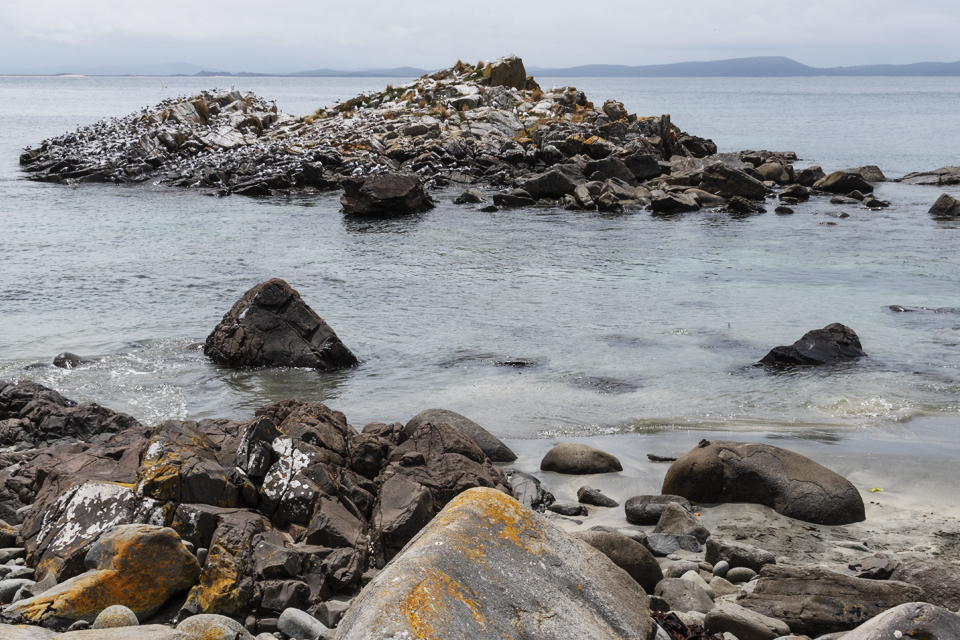
The walk along the coastline to Grass Point took us about 30 minutes. On arriving there we saw the remains of the many buildings that once stood there. These were the remains of one of about five whaling stations along this part of the coast and it is where early settlers brought their sheep ashore to graze. We lingered there for a short while, with photo opportunities including a rocky outcrop covered on various bird species and the rocks with the waves gently crashing against them.
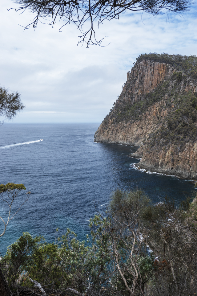
Progressing on toward the Cape, we started to climb higher and higher up a steep track that at times was quite rocky and crept very close to the edge of the cliffs, once again we were thankful for having brought our walking poles. This was hard work and at times seemed to be never-ending, but the views on the way were quite spectacular. At one point one of the scenic boat trips powered into the bay – we could only imagine what the cliffs looked like from the sea. Through the trees and shrubs at the cliff edge, we were also constantly reminded of our ultimate goal, 150 metres above sea level.
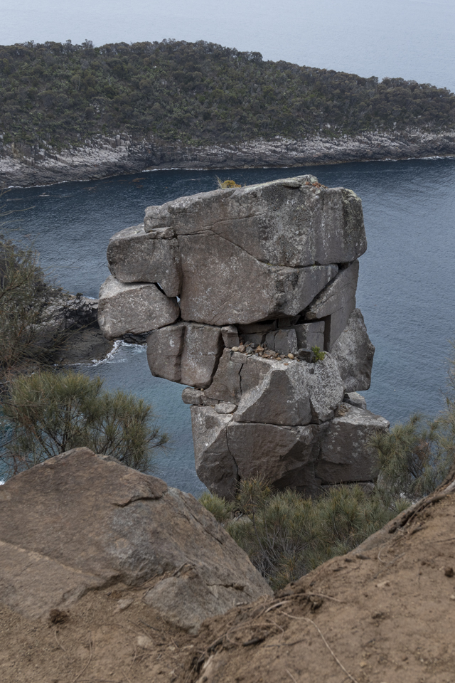
Towards the top, there is a well photographed, precarious looking rock, which, as far as I can ascertain, does not have a name. Of course, I had to take my own shot, but it meant getting as close as possible to the cliff edge. Some of you will be aware of my fear of heights, so the only way to get a reasonable angle was on my backside edging as close to the edge as I dare!
When we eventually reached the top, it was time for some refreshments and to take in the view before making our way back to the car. Until half way down the weather had been kind to us, but the rain started and didn’t stop until after we arrived at the campsite where we pitched the tent in between showers.
On reflection, we were happy that we chose the clockwise direction because our knees would have suffered on the descent down the steep part of the track. On all our walks, we found it interesting to compare the classification of the walk with our own assessment, with some varied results. The Fluted Cape walk was classified as ‘easy to moderate’ in our guide book, but we felt this to be somewhat generous. The 7.5 km circuit was estimated to take 2 – 3 hours – we took a full three hours, and we are not normally slow walkers. This is probably not a walk we would do again, but we were very pleased to have experienced/survived it.
In my next post, I will describe our second walk on Bruny Island – Luggaboine.